
Marysville Previous Residents by Era
Past residents of a Marysville address are found through a series of local record layers, not one complete household list. The Recorder's land records hold the ownership thread. The online date range matters because an index can exist without a matching online image. The Library's digitized Early Marysville and Union County Directories are a historical name-and-address lead, although the crawler did not expose a complete run of years or publishers. Census, Probate, cemetery, newspaper, and Archives material can help test a household finding against a date and place.
| Trail source | Local coverage | Where held | What it can establish |
|---|---|---|---|
| Recorder deeds and deed indexes | Deeds and indexes described from 1800 to present | Recorder and Archives series | Recorded owners and legal-location chain |
| Online Recorder images and indexes | 1995 to current | Recorder portal | Modern instrument and image route |
| Historical online deed indexes | Grantor and grantee, 1875 to 1994 | Recorder historical series | Name bridge to an earlier instrument |
| Early Marysville and Union County Directories | Exact year run not captured in official crawler | Library-linked digitized collection | Historic name and address lead after the volume is inspected |
| Federal population census | Released through 1950 as of 2026 | National Archives and genealogy access paths | Household composition at census date |
| Probate and Archives sources | Many local records begin in 1820; will index is 1852 to 1919 | Probate, Archives, and Library | Estate, heir, death, or document-volume clues |
Start with the era closest to the address question. A current property question begins with the parcel and Recorder. A family-history question may begin with a dated directory or census entry and then move to the legal description. Note: Record the collection title and the exact volume or page before drawing a Marysville past-resident conclusion.
Marysville Past Residents Start at Parcels
The current parcel is the safest starting point for Marysville previous-residents work because it connects a street address to a county parcel number and a land description. Union County's GIS instructions advise opening the parcel-search window, choosing a method, and beginning with less text, such as a house number, last name, or part of a title. A selected row shows a parcel number and owner name, then the Appraisal Info link opens more detailed parcel information and history. The owner is a recorded property fact, not proof that every person at the site lived there.
The County's Beacon help page is the official source represented in this screenshot.
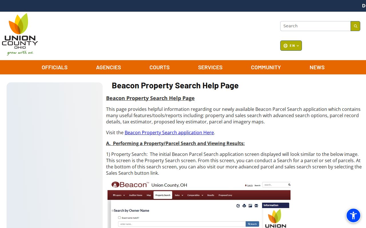
The official help material shows why a selected parcel, rather than an unverified map label, is the stable beginning of a backward address trail.
Preserve the address as it appears, but also keep any lot, addition or subdivision, section or survey, parcel, plat, and book or page reference available from the selected material. A physical address can change in form. The legal description is the comparison key that lets a researcher decide whether older recorded land and a modern Marysville house point to the same property.
Marysville Past Resident Index Breaks
Union County's Recorder has a useful but divided online trail. Images and indexes run online from 1995 to the present. It also provides added deed grantor and grantee indexes for 1875 through 1994, a mortgage grantor index for 1944 through 1994, and miscellaneous grantor and grantee indexes for 1960 through 1994. Those are name-index bridges, not a promise that every earlier document image can be opened online. The Recorder and Archives describe deeds and deed indexes from 1800, so older work may continue at the office even after the browser route stops.
The Recorder's historical index and record-series page is shown below.
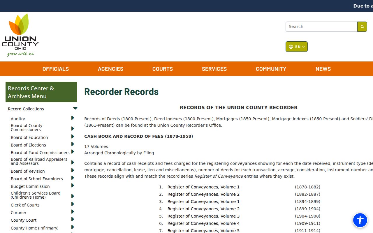
The source illustrates the historical-index path that bridges online modern records and original recorded volumes.
For a missing pre-1875 index result or an unavailable image, contact the Recorder before traveling and provide the party name, approximate period, or book and page when known. The Records Center & Archives at 128 S. Main Street is a historical fallback with a reading room, scanned series pages, microfilm, and public terminals. It is open Tuesday through Thursday, 9 a.m. to 4 p.m.; its archivist can route a request for a retained county record or explain where the originating office holds it.
Marysville Previous Residents Deed Trail
A chain of title follows recorded transfers backward from a current parcel. Begin with the current owner and legal descriptor supplied by the county property record. In the Recorder index, search that owner as grantee, the party who received the property, and identify the acquisition instrument. The seller named there is the grantor. Search that seller as grantee for the seller's own earlier acquisition, then repeat. Where a name appears more than once, compare the town or township, section or survey, lot, addition or subdivision, and book or page before joining the entries.
- Save the selected parcel number, address, current owner spelling, and legal description from the Auditor or GIS result.
- Use the Recorder index to find the current owner's acquisition as a grantee and preserve the cited volume, page, or instrument detail.
- Write down the seller or grantor on that instrument, then search the seller as a grantee for the preceding acquisition.
- Repeat the sequence while comparing the legal location, not only the party name or a modern street number.
- Move from 1995-current images to the listed historical index periods, then ask the Recorder or Archives about original volumes for earlier work.
- Grantor
- The party transferring an interest in recorded land.
- Grantee
- The party receiving that recorded interest. Searching a seller as a later grantee can lead to the prior purchase.
- Chain of title
- The sequence of recorded transfers linked by parties and legal property details.
- Legal description
- The land identifier, such as town or township, section or survey, lot, or addition, that is more durable than a street label.
Mortgage and miscellaneous index results can supply party or document context, but they do not independently prove ownership. Keep them separate from the deed transfer sequence.
Marysville Past Resident Address Keys
A historic Marysville address needs a continuity check before it is carried backward. The City Code contains dedicated tables for change of street name, annexation of territory, vacated streets and alleys, dedication and plat approval, and zoning-map actions. The research did not locate a verified citywide renumbering event or a verified date for a particular street rename. Use the special-ordinance tables, Recorder plats, Engineer historic tax maps, and legal-description comparison instead of inventing a conversion rule.
Union County's property and survey resources include interactive tax maps, atlases and plat maps, survey records, Virginia Military Surveys, subdivision plats, school-district maps, and railroad maps. Historic paper tax maps are also part of the Engineer's resources. Plats show streets, roads, alleys, subdivisions, annexations, original deed holders, surveyors, and approvals. That makes them practical evidence when a directory spelling or old number does not align with a current map.
The 2025 Archives report adds a narrow local bridge: Engineer Record Records from 1806 through 1901 were indexed and correlated with current roads in 609 entries. Ask which record series or time period is indexed or imaged rather than assuming every former road name converts directly to a present street. Note: Preserve the legal description and source date before deciding that two Marysville street forms identify the same parcel.
Marysville Previous Residents in Directories
The Marysville Public Library links its Early Marysville and Union County Directories to a digitized Columbus Metropolitan Library collection. The collection platform required JavaScript during research, so no exhaustive year run, publisher list, sample entry, or exact address-arranged format can be claimed here. Open a specific item, record the title and publisher exactly as shown, preserve initials and spelling, and copy an address verbatim when one appears. The historical collections themselves are detailed on the Marysville city directory page.
A directory result is a dated lead, not an automatic answer about every past resident. Compare the historic address against a current parcel and plat. Then carry the name to a Recorder legal description, a newspaper notice, a later directory, or an estate record. The Library's local collection page also links cemetery records, yearbooks, church and community histories, photographs, life histories, German-settlement material, World War I sources, and a probate will index. Each source has a different date and purpose, which is why agreement across records matters.
- Select and date a specific directory volume before searching a surname.
- Copy the name and address exactly, including initials, suffixes, and a locality qualifier.
- Compare the address to county GIS, the parcel's legal description, and relevant plat or ordinance records.
- Pair that directory year with the closest released federal census year and compare the household evidence carefully.
- Use Probate, cemetery, or newspaper material as an endpoint check, not as proof that a living person is still connected to the address.
Federal census schedules are released after 72 years; 1950 is the latest released decennial federal census as of 2026. A census is household-level evidence at its census date, while a directory and a deed are different kinds of records.
Marysville Previous Residents Record Endpoints
When a deed chain and directory suggest a family trail, use county historical sources to test dates and relationships. The Library's Index to Probate Will Record covers 1852 through 1919 and supplies a last and first name, document type, will volume, and page. Probate records extend through several access paths: modern records after June 1, 2019 are online, while Probate records from 1820 through May 30, 2019 require a deputy clerk or public terminals at the Archives or Recorder. Marriage records begin in 1820; historical local birth and death volumes cover 1867 through 1908.
The county's online vital-statistics records page is the source captured in this image.
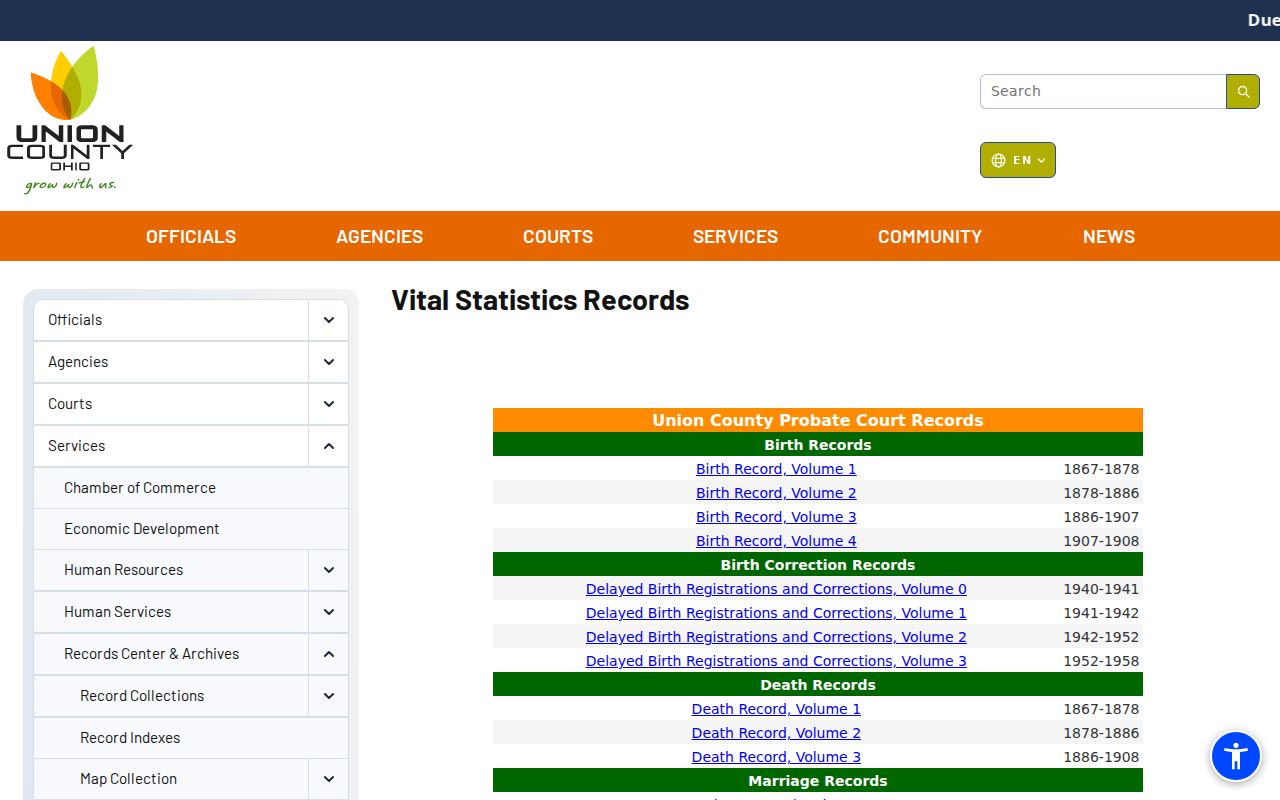
Scanned historical volumes can route a researcher to an event record, but they should be read with the correct era and custodian in mind.
For a later event, the Union County Health Department issues Ohio birth and death records from 1909 to the present through its online ordering route. Probate holds marriage records from 1820 to the present. A certified death copy with a decedent's Social Security number has a five-year restriction unless an authorized requester makes the specific request and provides proof under ORC 3705.23(A)(5). The right record can corroborate an event or estate trail, but it does not establish a present address for anyone.
Marysville Previous Residents Archives Route
Use the Archives when the online path ends. Union County's Records Center & Archives opened in 2008 and has a reading room with immediate access to many permanent and historical records, about 3,300 bound volumes, and storage for more than 9,900 cubic feet. Historic research is divided among Recorder originals, Probate and court counters, scanned county series, archive microfilm, Library collections, and Historical Society papers. The division matters because a web nonmatch can mean the index, image, or original is held elsewhere.
The county's 2025 report says the Archives scanned 374,046 OnBase images, completed a Clerk case-index project for 1820 through 1990 with 155,780 entries, and made Commissioners' Journals available online back to 1820. These improvements expand discovery, but they do not mean every old Marysville address is name-searchable. Ask the archivist which series and years are indexed or imaged, then give the address, legal description, party name, or book and page already established from the parcel and Recorder work. Note: The strongest backward trail separates recorded ownership from household evidence and marks each source's date.
Lawful Marysville Past Resident Research
Past-resident work is appropriate for family history, estate and heir research, a property story, or checking a specific recorded document. It has clear limits. A recorded owner is not every occupant, a historic directory entry is not a permanent residence claim, and a voter or vital record may be protected or restricted. Ohio Safe at Home lets qualified participants use a substitute address for voter and government records. ORC 149.45 also provides a route for covered personal-information redaction from internet records, while the relevant public office remains the place to send a request.
Lawful use. Use Marysville previous-residents records for personal, lawful history and property research. Do not use a past address or record to stalk, threaten, harass, impersonate, or harm anyone.
Ohio law prohibits menacing by stalking under ORC 2903.211 and telecommunications harassment under ORC 2917.21. If a record search reveals an immediate threat or suspected identity misuse, stop the research, preserve the information, and contact 911 or the appropriate local agency. For a suspicious deed-copy mailer, verify the instrument through the Recorder rather than relying on a phone number printed on the solicitation.